
The Piri Reis Map: Did It Show Antarctica Before Discovery?
The Piri Reis Map, an enigmatic cartographic creation, has intrigued historians and researchers for centuries. This ancient map, believed to have been crafted by the Ottoman Turkish cartographer Piri Reis, offers a fascinating glimpse into the past, featuring depictions that challenge conventional understanding. In this blog, we will delve into the intriguing story behind the map, exploring the life of Piri Reis, the compilation process, and the controversial depiction of Antarctica.
Piri Reis: The Cartographer Behind the Mystery
Piri Reis, a distinguished Ottoman admiral and cartographer, was the mastermind behind this mysterious map. Born in 1465, his life was marked by a passion for exploration and a keen interest in cartography. Reis served in the Ottoman Navy, contributing significantly to the empire's maritime expertise.
Ahmed Muhiddin Piri ( c. 1465 – 1553), better known as Piri Reis
Compiling the Map: A Masterpiece Takes Shape
Crafted in 1513, the Piri Reis Map is a remarkable piece of cartography, showcasing parts of South America, Africa, and Antarctica. The map is a compilation of various sources, including ancient maps, sea charts, and explorers' accounts. Piri Reis combined this diverse information to create a comprehensive and visually striking representation of the known world at the time.
 Piri Reis Map showing Antarctica with no ice
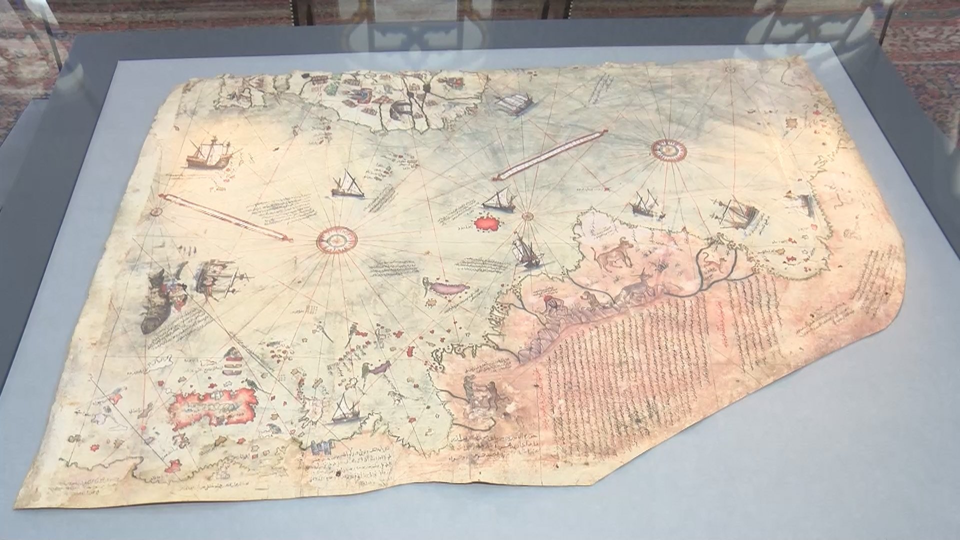 Piri Reis Map displayed at Istanbul's Topkapi Palace
Challenging Historical Narratives about Antarctica:
What sets the Piri Reis Map apart is its controversial portrayal of Antarctica, particularly the suggestion of an ice-free landscape adorned with pastures and trees. This depiction has sparked intense debate among scholars and scientists. According to conventional geological understanding, Antarctica has been covered in ice for the last 34 million years. The map's portrayal challenges this narrative, raising questions about the source of Piri Reis's information and the possibility of ancient, lost knowledge.
The Enigmatic Antarctica Section:
A graphical depiction of the Antarctica section of the Piri Reis Map further emphasizes the controversy. Created by ancient spook artists, this illustration captures the essence of the map's unique portrayal, inviting viewers to question the conventional historical understanding of Antarctica's glacial history.
